It’s that time of year again! Now that our hallmark “nor’easter” is no longer a weather threat, we turn our attention to a different threat... severe weather.
It’s in the month of May that severe storms reach their peak nationwide, but here in Massachusetts, we’re just getting warmed up.
Being farther north in the U.S., it takes more time for heat and humidity, storm “fuel,” to build up. That’s why we typically don’t see much in the way of thunder and lightning until the calendar flips to May.
By June however, our traditional severe weather season begins. It runs through the month of August with a peak coming in July.
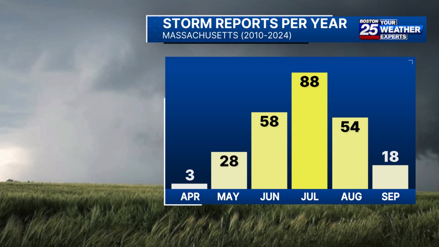
Using data from the last 15 years, we did some research on the average number of storm reports by month across Massachusetts. For our purpose, a “storm report” is defined as a significant hail or wind measurement, the presence of a funnel cloud, or damage from either wind, hail, or a tornado.
To no surprise, we saw these reports peak in the summer months, with a clear maxima in July. Also worth noting is that storm reports ramp up quicker in the spring than they tail off in the fall (we typically see more activity in October than April, in fact!).
Additional data from NOAA tells us that our peak tornado and wind threats also arrive in mid July, while our peak hail threat occurs a couple weeks earlier.
Wherever you are this summer, keep an eye to the sky and let us know what you’re seeing out there! You can always share your weather photos & videos with us here! https://www.boston25news.com/share-your-pics/
©2025 Cox Media Group
/cloudfront-us-east-1.images.arcpublishing.com/cmg/7QOJU3BNCJERBNKJC5LWTBYFLU.png)


