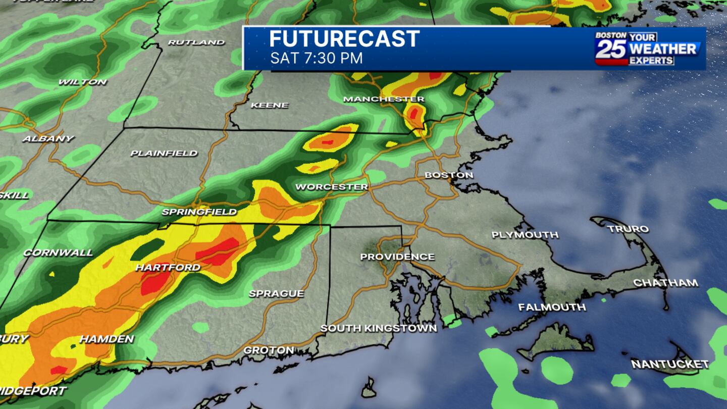
DEDHAM, Mass. — A round of severe storms is expected to move through southern New England on Saturday, bringing threats of damaging wind gusts, flooding, hail, and even a tornado in Massachusetts.
The highest risk for severe storms is across western Massachusetts, Worcester County, and the Merrimack Valley, according to the National Weather Service.
Boston 25 News Meteorologist Tucker Antico warned that the peak of the storms is expected between 2 p.m. and 8 p.m.
My latest thoughts on severe weather across the Northeast tomorrow afternoon (2-8PM)...
— Tucker Antico (@tuckerweather) September 5, 2025
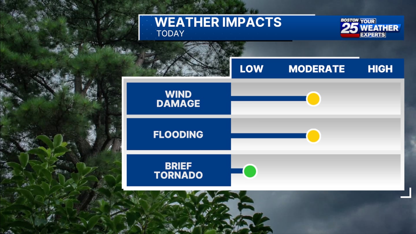
Solid shear & bowing segments make wind a top hazard. Training storms & high PWAT put flooding up there too. We'll need to be ready for an isolated tornado or two as well. pic.twitter.com/LXeN8ELZIx
Temperatures in the mid-80s and humid conditions will fuel an afternoon front, packing the ingredients for summer storms west and north of Boston.
“I am most concerned about wind damage and also some localized flooding,” Antico said in his Friday forecast. “And I’ll say this, while it’s very unlikely, a tornado cannot be ruled out.”
The South Shore, Cape Cod, and the Islands are expected to stay dry on Saturday. There is the possibility of rain reaching Boston and the coastlines later in the evening, but the chance of severe weather will have diminished by then, according to Antico.
Sunday is shaping up to be drab, with plenty of moisture in the forecast.
Because it will be cooler and less humid, severe weather isn’t a concern, but southern New England is in for cloudy skies and on-and-off showers.
For the latest forecast updates, stay tuned to Boston 25 News on-air and online.
Download the FREE Boston 25 News app for breaking news alerts.
Follow Boston 25 News on Facebook and Twitter. | Watch Boston 25 News NOW
©2025 Cox Media Group
/cloudfront-us-east-1.images.arcpublishing.com/cmg/7QOJU3BNCJERBNKJC5LWTBYFLU.png)


