It may be Valentine’s Day, but southern New England is not feeling the love from Mother Nature this weekend as a winter storm threatens to bring snowy and icy conditions across the region.
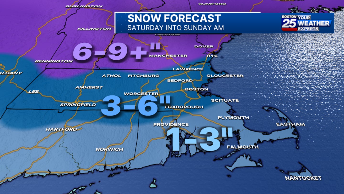
“Snow is expected to begin falling Saturday evening, between 5-8 p.m., moving in from west to east. The snow will continue into early Sunday morning,” the Boston 25 Weather team wrote in their latest weather blog.
Estimates show the possibility of 1-3 inches of snow for the Cape and Islands, 3-6 inches for points south of the Massachusetts Turnpike and along the coast.
Six to nine or more inches of snow is possible for points north of Interstate 90, including Fitchburg and southern New Hampshire.
Temperatures are projected to slowly warm overnight into Sunday, causing a change to rain in Boston and southeastern Massachusetts. However, if the current forecast holds, ice may be a “big problem” for towns to the north and west, according to the Weather Team.
This will be very messy Sunday morning, especially across the interior.” Boston 25 Meteorologist Tucker Antico said. “The ice potential is the biggest concern with this if you’re in the Worcester Hills and out towards the Berkshires, Southern New Hampshire, and Vermont included in this as well. Isolated potential for up to a quarter of an inch of ice, up to a tenth of an inch is possible.”
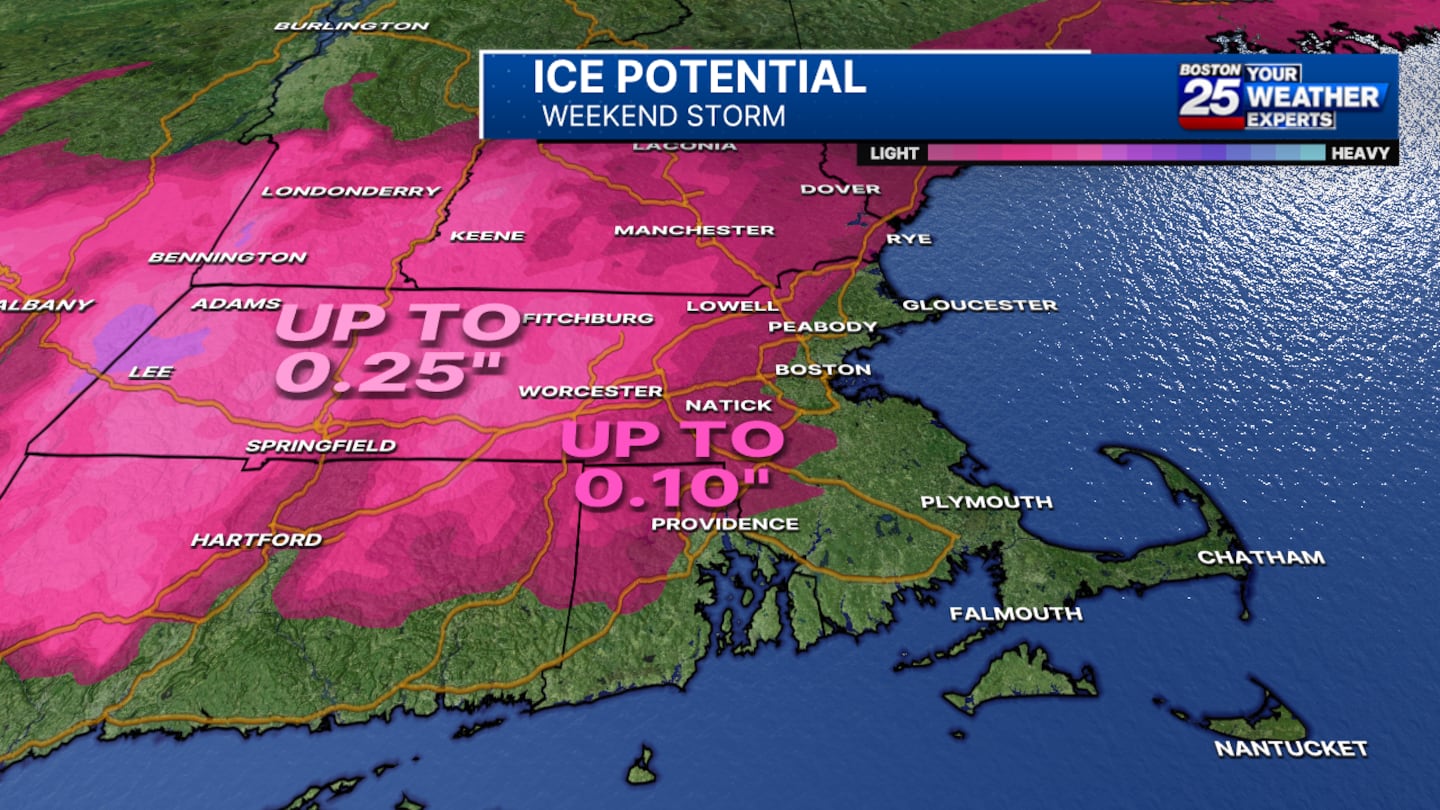
“This will be a significant storm across the interior. Lesser impacts east of I-495.” Antico writes.
WEEKEND STORM... Forecast remains largely unchanged. Worst of it occurs between Saturday night and Sunday afternoon.
— Tucker Antico (@tuckerweather) February 15, 2025
A quick several inches of snow overnight become ice & rain Sunday morning. This will be a significant storm across the interior. Lesser impacts east of I-495. pic.twitter.com/BbRAJVkVGn
For the latest on the forecast, stay tuned to the Boston 25 Weather page.
This is a developing story. Check back for updates as more information becomes available.
Download the FREE Boston 25 News app for breaking news alerts.
Follow Boston 25 News on Facebook and Twitter. | Watch Boston 25 News NOW
©2025 Cox Media Group
/cloudfront-us-east-1.images.arcpublishing.com/cmg/7QOJU3BNCJERBNKJC5LWTBYFLU.png)


