The National Weather Service is letting us know we’re in for a storm this weekend and we should get ready for up to 6 inches of snow.
Counties that are placed under Winter Storm warning include Franklin, Worcester, Middlesex, Essex, Hampshire, Hampden, Norfolk, Bristol, Plymouth, and Berkshire counties from 7 p.m. on Saturday through 1 p.m. on Sunday.
The worst of the snow will fall between 11 p.m. and 7 a.m., so if you’re out late, stay prepared for slippery roads, said Tucker Antico.

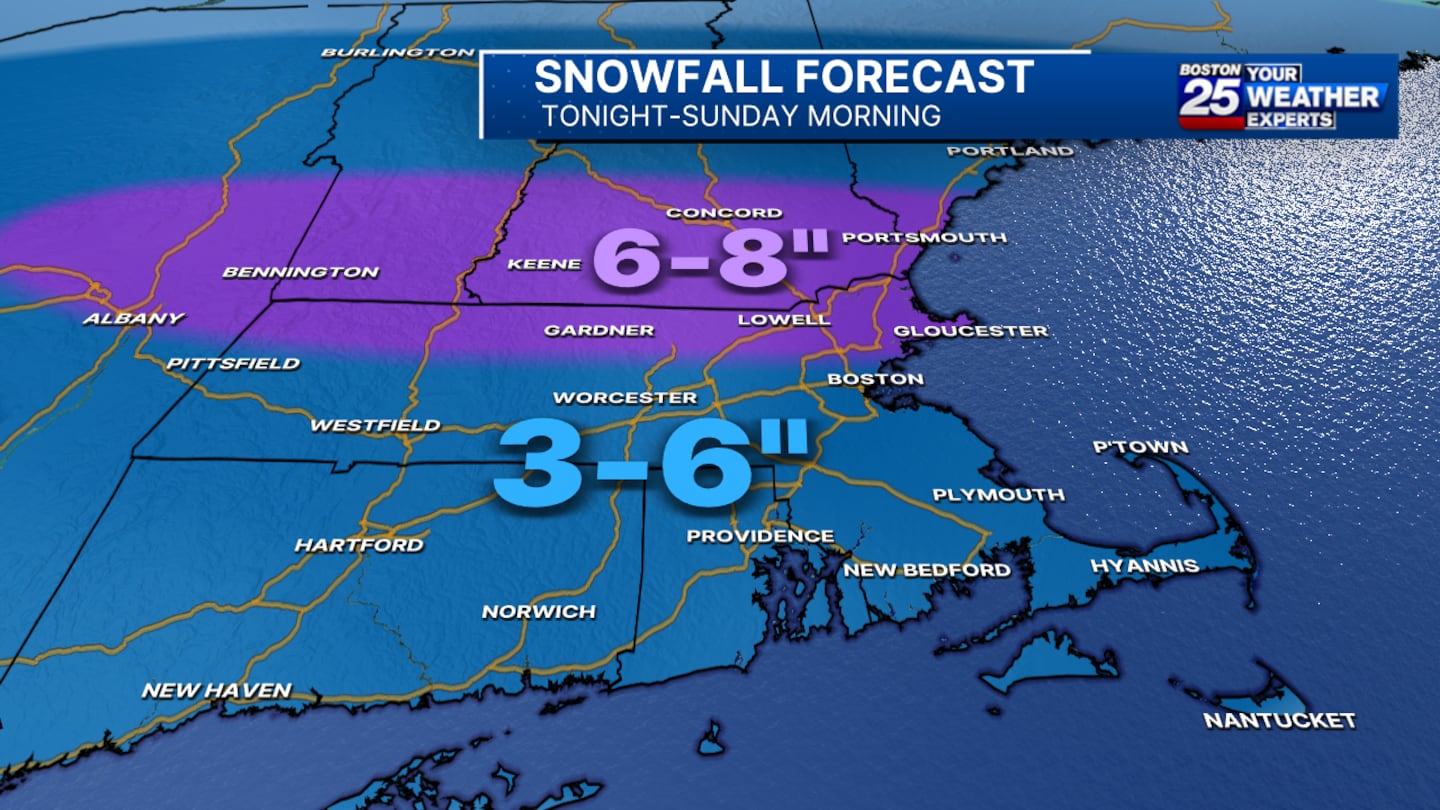
“I’m putting a range of 4 to 8 inches, and this is for a good portion of Massachusetts,” said Meteorologist Vicki Graf in her morning forecast.
Graf also pointed out that this is a range and that some areas will see 5 to 6 and others could see 7 to 8.
Antico noted that with the dryer air, snowfall on the back end will be limited.
FINAL CALL: Snow arrives in the next couple of hours and will produce at a solid rate for some time overnight.
— Tucker Antico (@tuckerweather) February 9, 2025
On the back end, dry air will limit snowfall, more notably with southward extent. This is fluffy stuff north and wetter stuff south. pic.twitter.com/Yn7xWofN9R
“I wouldn’t rule out a couple of spots to see a little more than 8 inches especially North of the Boston area,” Graf said.
This snowstorm should wrap up early Sunday morning, so if you have any Super Bowl plans you shouldn’t be impacted.
As Tucker pointed out, fluffier snow will be more towards the north, while the wetter stuff will lean more south.
There is also a “good chance” we see more snow “on at least one, if not two days next week,” according to Meteorologist Tucker Antico.
Download the FREE Boston 25 News app for breaking news alerts.
Follow Boston 25 News on Facebook and Twitter. | Watch Boston 25 News NOW
©2025 Cox Media Group
/cloudfront-us-east-1.images.arcpublishing.com/cmg/7QOJU3BNCJERBNKJC5LWTBYFLU.png)


