DEDHAM, Mass. — Another weekend winter storm is approaching which will bring snow, and dangerous icy conditions to Massachusetts.
Snow is expected to begin falling Saturday evening, between 5-8 p.m., moving in from the west. “The steady stuff doesn’t begin until we get towards the later hours in the evening, closer to 10 to 11 p.m.,” the Boston 25 Weather team wrote in their latest weather blog.
A Winter Weather Advisory goes into effect Saturday night and lasts through Sunday night for most of Massachusetts (excluding the Cape and Islands).
“The worst of the travel will be early Sunday morning with snow, ice, and rain,” said Boston 25 Meteorologist Vicki Graf in her Saturday morning forecast.
Estimates show the possibility of 1-3 inches of snow for the Cape and Islands and 3-6 inches for points south of the Massachusetts Turnpike and along the coast.
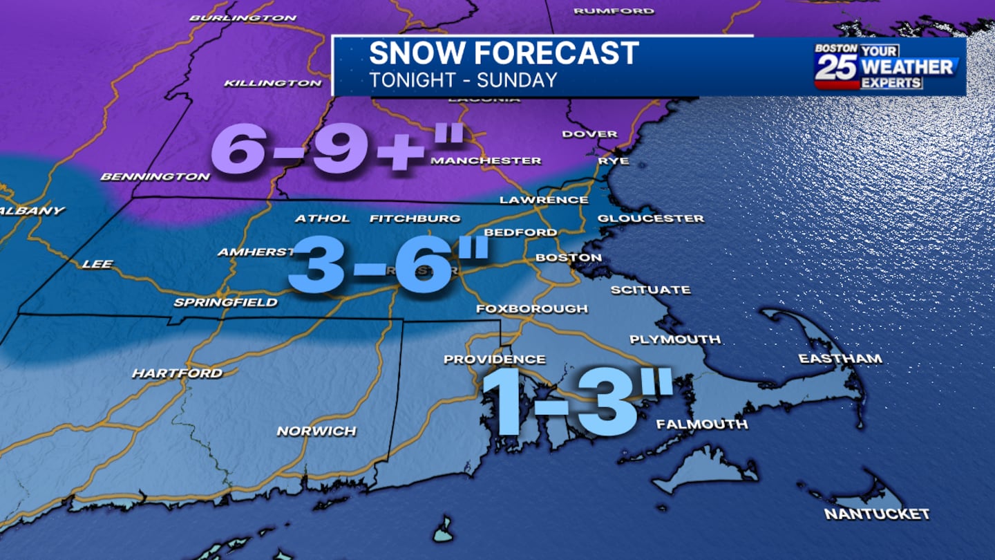
Six to nine or more inches of snow is possible for points north of Interstate 90, including Fitchburg and southern New Hampshire.
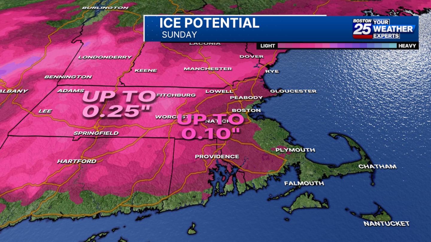
“As the storm winds down, there’s still a lingering threat for icy spots,” Graf said.
When it comes to ice, some areas will see about a quarter of an inch which can be really disruptive. “We’re looking at a lot of those tree limbs and branches starting to sag or break, we’re looking at some slick travel out there and also potentially power outages,” Graf added.
On Monday, the winds will pick up significantly and a high wind watch has been issued for the day with gusts possibly reaching up to 60 mph which could lead to power outages.
For the latest on the forecast, stay tuned to the Boston 25 Weather page.
This is a developing story. Check back for updates as more information becomes available.
Download the FREE Boston 25 News app for breaking news alerts.
Follow Boston 25 News on Facebook and Twitter. | Watch Boston 25 News NOW
©2025 Cox Media Group
/cloudfront-us-east-1.images.arcpublishing.com/cmg/7QOJU3BNCJERBNKJC5LWTBYFLU.png)


