
BOSTON — As we prepare to begin the month of September, all eyes are on the next polar blast! Lucky for New England, it will be more of a glancing blow. However, this may have you wondering... how is it possible for the polar vortex to emerge THIS early?

While we generally hear about the polar vortex during the winter months, it is always present to our north. However, the same processes that weaken the vortex and bring its cold air to us, occur in the warm months too.
Frost and freeze warnings are likely to go into effect across the North Central US towards the middle of this week as the cold air enters. Unlike winter months though, the long days and and lack of snowpack mean this air warms significantly during its travel from the polar region. In this case, the coldest air in the country will only yield lows in the 30s and highs in the 50s over states like Minnesota, Wisconsin, and Michigan. In the figure below, you can see connection between the cold air in this part of the country and it’s origins in the arctic!
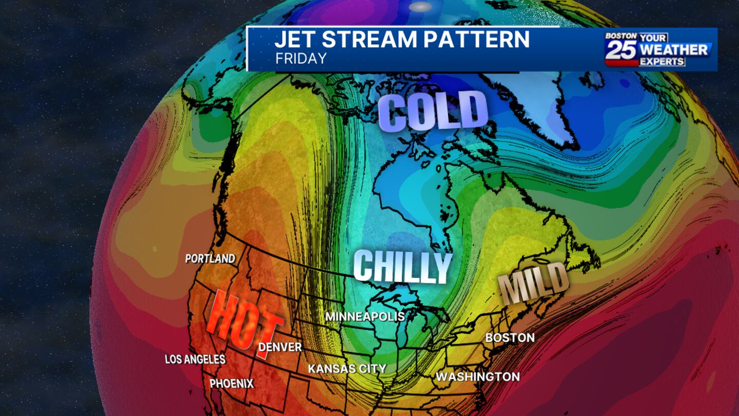
This cold air will swing farther east as we reach next weekend. As it does, the jet stream will shift directly over our region. Stormy weather is favored when this occurs, and it’s the reason rain is in our forecast on Friday and Saturday.

Lucky for us, the polar air won’t quite sneak into southern New England. While we’re likely to be colder than average as a result, you do not need to prep for highs below 70 degrees... at least not YET!
Download the FREE Boston 25 News app for breaking news alerts.
Follow Boston 25 News on Facebook and Twitter. | Watch Boston 25 News NOW
©2025 Cox Media Group
/cloudfront-us-east-1.images.arcpublishing.com/cmg/7QOJU3BNCJERBNKJC5LWTBYFLU.png)


