DEDHAM, Mass. — A powerful nor’easter is moving into Massachusetts today, bringing a mix of heavy rain, strong winds, and the potential for coastal flooding.
Rain will begin pushing up from the south later this afternoon, likely reaching Boston sometime after 1 p.m. Temperatures will remain stuck in the 50s, and winds will gradually strengthen as the storm moves closer.
Latest storm timeline:
The heaviest rain and strongest winds are expected overnight into Monday. This is when the storm will really pack a punch, with widespread downpours and gusty winds leading to potential travel disruptions and isolated power outages.
Rainfall totals are projected to range from 1 to 4 inches across the region, with southeastern Massachusetts expected to see the highest amounts.
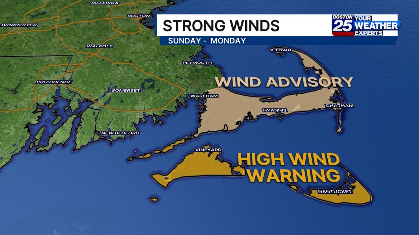
Winds will also be strongest in this area, with gusts potentially exceeding 50 mph across the Cape and Islands, increasing the risk of downed tree limbs and outages.
Rain arrives this afternoon from south to north. The strongest wind and heaviest rain hit overnight and continue through Monday. Coastal flooding is possible during high tides. Plan for a messy start to the week! pic.twitter.com/s0vDTGbxka
— Vicki Graf (@VickiGrafWX) October 12, 2025
Flooding Concerns:
Coastal flooding is another major concern, especially during high tide cycles.
A Coastal Flood Warning is in effect for parts of Suffolk County from noon Sunday through Monday evening, while a Coastal Flood Advisory is posted for other coastal areas between 2 and 6 p.m. Sunday.
Areas most at risk for flooding include Essex, Suffolk, Norfolk, Plymouth, Bristol, Barnstable, Dukes, and Nantucket counties.
Residents in flood-prone zones are urged to check FEMA flood maps to assess their risk and to prepare accordingly.
Strong Winds:
Several weather alerts have been issued in advance of the storm’s peak.
A High Wind Warning goes into effect at 5 p.m. Sunday for Nantucket and Martha’s Vineyard, continuing through 2 p.m. Monday.
A Wind Advisory is also in place for Cape Cod through Monday evening.
Winds of this strength could cause power outages, bring down tree limbs, and create hazardous travel conditions.
Boston 25 Meteorologist Vicki Graf warns that the combination of wind and rain will make for a messy and potentially dangerous start to the week.
Conditions will slowly begin to improve by Tuesday, though lingering showers are still possible.
Boston 25 News will continue to monitor conditions and provide live coverage throughout the storm.
For the latest updates on the storm, visit the link here.
This is a developing story. Check back for updates as more information becomes available.
Download the FREE Boston 25 News app for breaking news alerts.
Follow Boston 25 News on Facebook and Twitter. | Watch Boston 25 News NOW
©2025 Cox Media Group
/cloudfront-us-east-1.images.arcpublishing.com/cmg/7QOJU3BNCJERBNKJC5LWTBYFLU.png)


