
The Boston 25 Weather team is tracking the chance of several inches of snow in parts of Massachusetts on Friday, before the possibility of a larger ocean storm on Monday.
Friday will start dry, but unsettled wintry weather is expected to move in around midday.
Boston 25 Meteorologist Tucker Antico shared an updated snow map on Thursday night showing a decrease in expected totals.
“After dark, steady, light snow will accumulate across most of the region. Highest totals will be at elevation and north. Good for snowball-making!,” Antico said.
Friday PM Snow Forecast –
— Tucker Antico (@tuckerweather) February 19, 2026
Mild air & marginal precip limit the impact of this system, especially during the day.
After dark, steady, light snow will accumulation across most of the region. Highest totals will be at elevation and north. Good for snowball-making! pic.twitter.com/tpABv6R2it
The map is projecting 2-4 inches of snow for points north of the Massachusetts Turnpike. 4 to 8 inches of snow
Just a coating or up to 2 inches of snow is expected for parts of the South Shore, South Coast, and Cape Cod. The Islands look like they will stay free of snow.
A winter weather advisory has also been issued for parts of the state from 10 a.m. Friday through 7 a.m. Saturday.
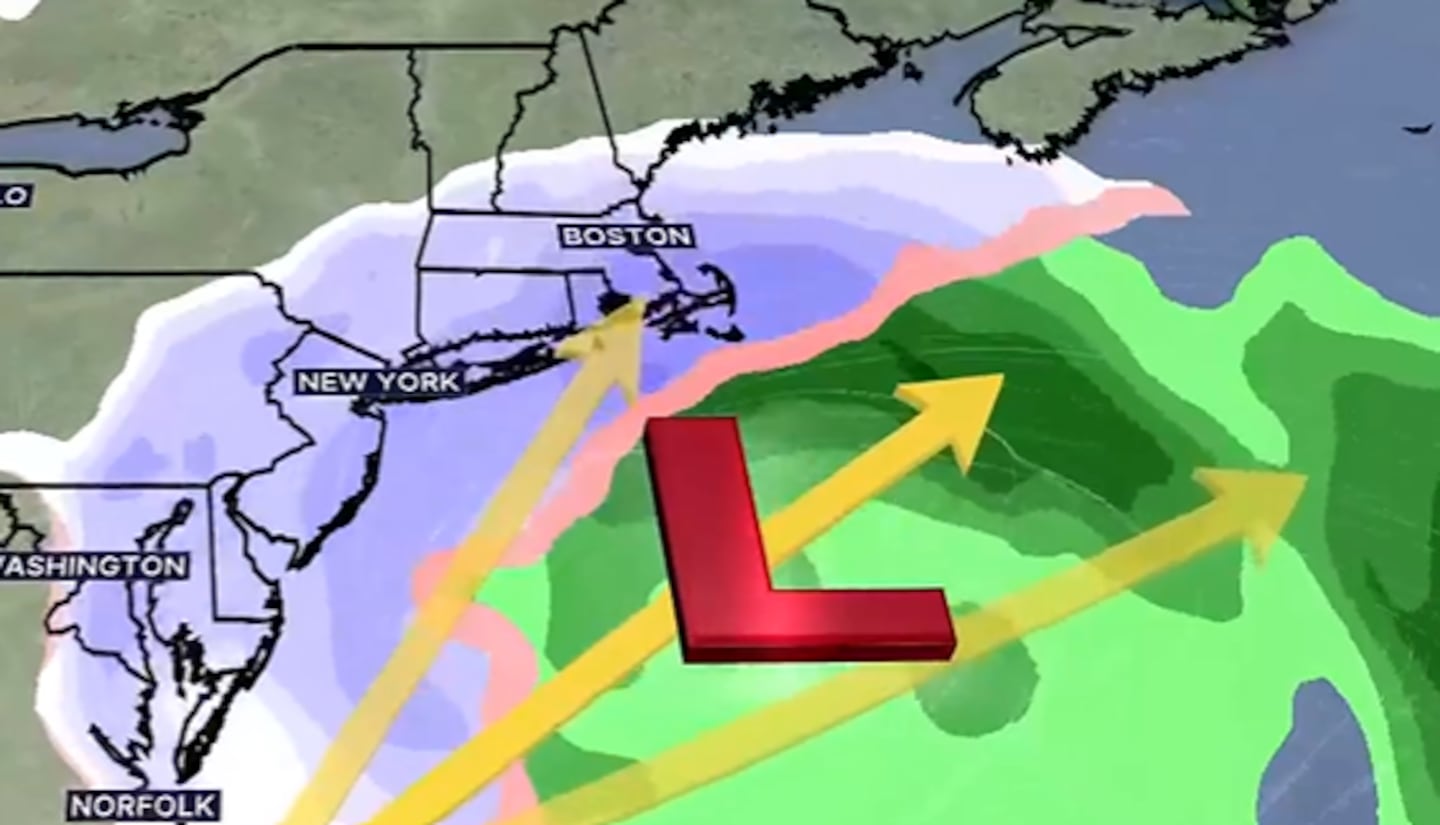
Our next storm chance will then come into view on Monday, but key details remain unclear.
Come Sunday afternoon, a developing ocean storm could intensify as it tracks northeast, bringing more snow into the region by early Monday morning.
The Boston 25 Weather team will continue to monitor the forecast and provide updates as the week develops.
For the latest forecast, visit the Boston 25 Weather page or download the Boston 25 Weather app.
Download the FREE Boston 25 News app for breaking news alerts.
Follow Boston 25 News on Facebook and Twitter. | Watch Boston 25 News NOW
©2026 Cox Media Group
/cloudfront-us-east-1.images.arcpublishing.com/cmg/7QOJU3BNCJERBNKJC5LWTBYFLU.png)


