DEDHAM, Mass. — We’re tracking the season’s first chance at accumulating snow in southern New England.
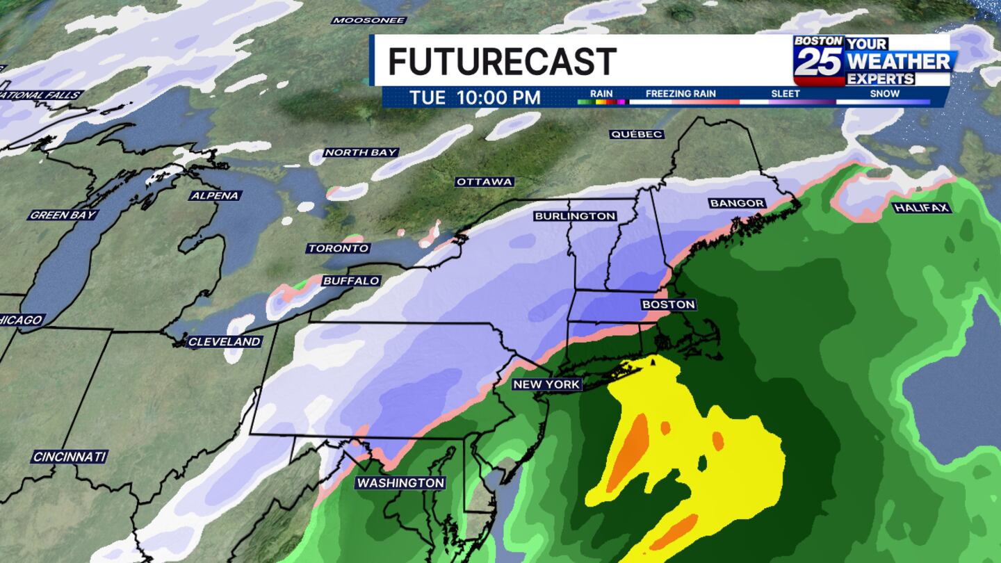
December has not produced much snow locally in recent years, but it seems like this one will be off to a quicker start. Cold air from the north will inundate the Northeast on Tuesday. At the same time, a strengthening system from the Gulf will bring moisture up the East Coast. The result will be a messy storm system in New England with rain, sleet, and snow.
The storm is likely to arrive in the afternoon on Tuesday and continue overnight. The biggest impacts will largely come Tuesday evening/night, especially during the commute. It’s likely the mixing line will not move much, so the rain-snow cutoff may end up fairly sharp, and this will dictate impact level too.
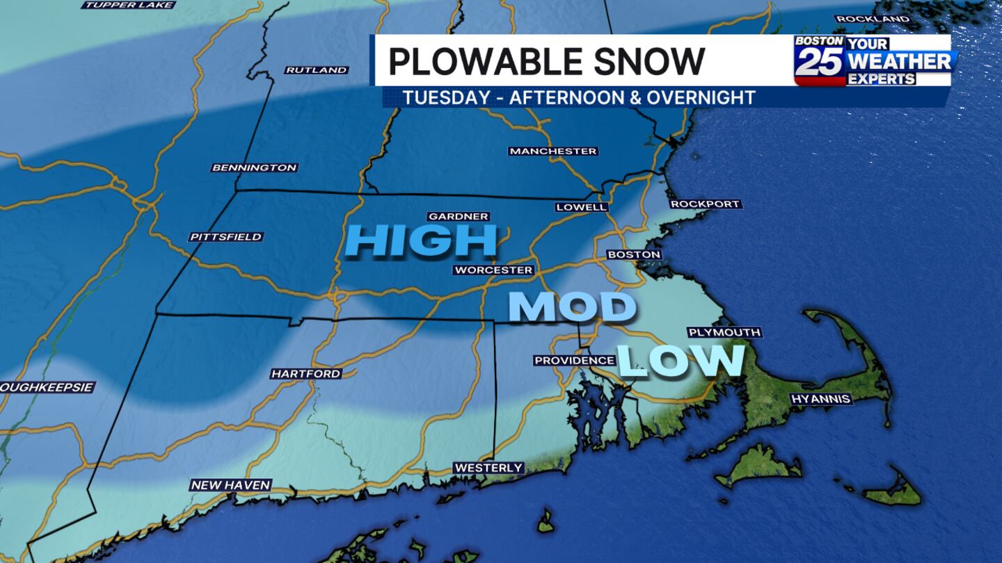
As of now, the hills and interior parts of Mass are most likely to receive a plowable/shovel-able snowfall. This is where temps are most likely cold enough for snow, ultimately. Coastal areas and localities with southward extent are likely to be too warm for snow. However, if our storm track is to nudge south, it would bring those probabilities up a little bit... that’s something we will be watching.
As of now, find the snow shovel and keep an eye on our forecast. This will not be a blockbuster storm. It’s unlikely we will see widespread 6″ amounts. It is however, likely to slow down travel and require clean up in many communities.
©2025 Cox Media Group


