DEDHAM, Mass. — A messy fall nor’easter that moved into Massachusetts late Sunday is continuing to linger Monday, bringing heavy rain and strong wind gusts to some communities, as well as coastal flooding concerns.
As of early Monday afternoon, the bulk of the rain was falling across central and eastern Massachusetts.
Track the nor’easter on live radar
Latest storm timeline
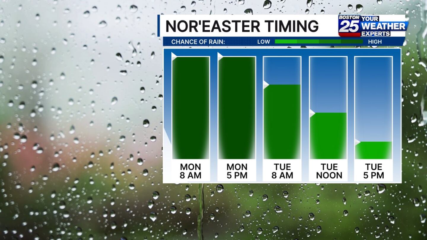
Steady rain is expected to fall throughout the day on Monday, lingering into the Tuesday morning commute.
Isolated showers and pockets of drizzle can be expected into the afternoon on Tuesday.
Skies will begin to clear in time for the evening commute.
Wednesday will feature the return of sunshine and temperatures in the 50s and 60s.
Storm impacts
Rain, strong wind gusts that could knock out power, and minor coastal flooding are the main storm concerns on Monday.
We’re looking at up to 4 inches of rain in some spots by Tuesday, while a widespread 1 to 3 inches of rain is expected for most areas, according to the Boston 25 Weather Team.
Wind gusts of 30 to 50 mph are expected in the Bay State, with the worst of it being felt on Cape Cod and the Islands.
A wind advisory is in effect for Dukes, Nantucket, and Barnstable counties until 8 p.m. Tuesday.
Coastal flooding is also possible for communities in Eastern Essex, Suffolk, Eastern Norfolk, Eastern Plymouth, Barnstable, Dukes, and Nantucket counties, where a flood advisory is in effect until 7 p.m. Tuesday.

For the latest storm updates, watch live coverage on Boston 25 News or visit the Boston 25 Weather page.
Download the FREE Boston 25 News app for breaking news alerts.
Follow Boston 25 News on Facebook and Twitter. | Watch Boston 25 News NOW
©2025 Cox Media Group
/cloudfront-us-east-1.images.arcpublishing.com/cmg/7QOJU3BNCJERBNKJC5LWTBYFLU.png)


